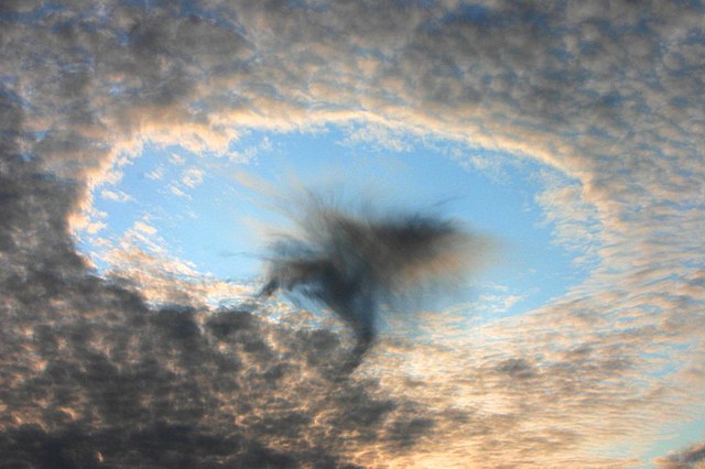
 Over the years, cloud shapes have been standardized and recorded in the International Cloud Atlas.
The atlas which was first released in 1896 has become an important tool for meteorologists-in-training and students who study aviation.
This year, for the first time, the Cloud Atlas is being released in full online, as well as in print. The publication will be accompanied by a change that hasn’t occurred for 30 years: the addition of new clouds in the Atlas.
The Science Behind Clouds
Clouds begin forming near the ground, where the warmer air holds water vapor.
Since warm air expands to become less dense than cold air, it rises. The warm air then cools making it harder for air to hold the water vapor. The vapor then condenses around small dust or pollen particles, forming little droplets around them. Billions of these droplets come together to form a visible cloud mass. The process described is called convection, the way most clouds are formed.
But if all clouds form in the same way, why are there different cloud types? It’s because no two convection processes are exactly the same. Slight alterations in the formation process affect the shape of clouds. For example, a gentler, warmer process when water vapor rises results in flatter clouds. On the other hand, clouds with more ice crystals instead of water vapor give the cloud a wispier and feathered look.
Cloud Shapes, And New Clouds
 Most of the time, clouds are grouped together based on altitude. The lowest clouds, which are below 6,000 feet, include the stratus, stratocumulus, and cumulus clouds. Stratus clouds are layered and gray, accompanied by light mist or a drizzle. Stratocumulus and cumulus are puffy masses and usually signal an upcoming storm.
The middle region includes altostratus, altocumulus, and nimbostratus clouds, which are between 6,000 and 20,000 feet. These clouds come in all different shapes and are accompanied by light rain as well. The highest clouds are the cirrus, cirrostratus, and cirrocumulus clouds. Most are seen during fair weather and are wispy, but cirrostratus clouds can lead to rain and snowstorms.
Recently, 11 new clouds have been added to the atlas. The most notable addition is a cloud known as the Asperitas, first seen in Iowa in 2006. Asperitas is Latin for “roughness” and is given to the cloud because of its wave-like and chaotic shape. Others include the volutus or roll cloud, the hole-punch cavum cloud, the wave-shaped Fluctus cloud, as well as a few special clouds.


