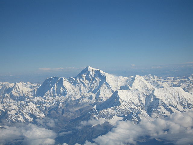
 When asked to imagine the world’s tallest mountain, which one comes to mind? Most people immediately think of Mount Everest, which at a whopping 29,029 ft (8,848 meters), is indeed the tallest mountain.
But what if I told you that there is a chance that this legendary mountain has actually shrunk in size? Yes, you heard it right!
In 2015, Nepal was struck by a 7.8 magnitude earthquake. Satellite images show that the capital city Kathmandu rose by 3 feet, while Mt Everest shrunk by one inch. And so, India’s Surveyor-General Swarna Subba Rao is out to uncover the truth.
Where Is Everest?
Mt Everest is the Earth’s highest mountain, found in the Himalayan Mountain Range. It forms the border between the countries of Nepal and Tibet in the continent of Asia.

Nepal sits at the juncture of two tectonic plates -- sections of the Earth’s crust that come together to form the entire Earth’s surface. When the two tectonic plates rub together causing the earthquake, there is a chance that the areas around it may have gone up and down.
The mountain first came to the world's attention in 1856, when India published a survey that said Mount Everest’s (then called Peak XV) height was 29,002 ft (8,840 meters). Since then, Mt Everest’s height has been disputed by many countries. From 2005-2010, China and Nepal were in a disagreement: China believed Everest’s height was 29,016 feet (8844 meters), while Nepal insisted that it was 29,029 (8,848 meters) tall. What was the reason behind these different measurements? Nepal measured the snow on the top of the peak, while China didn’t.
How Are Heights Measured
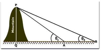
 Scientists and professional surveyors use a method called triangulation to find out the height of mountains.
To calculate the elevation of a mountain, scientists first measure the distance between two points on the ground. They then measure the angles between each point on the ground and the top of the mountain using a telescopic device known as theodolite -- much like a protractor you use in classrooms. Once you know two angles and one side, using principles of geometry, the height of the mountain can be calculated.
Scientists plan to use triangulation, along with GPS satellites to pinpoint the specific location of the mountain’s peak. GPS technology can accurately predict the latitude, longitude, and height of the mountain as long as the signals are clear. Since installing a GPS receiver at the peak is not possible, it is done at base camp.
Using these strategies, India’s Surveyor-General Swarna Subba Rao’s team will determine if Mount Everest has indeed shrunk. Of course, it will still hold the title for the tallest mountain and will remain as legendary as ever!


